
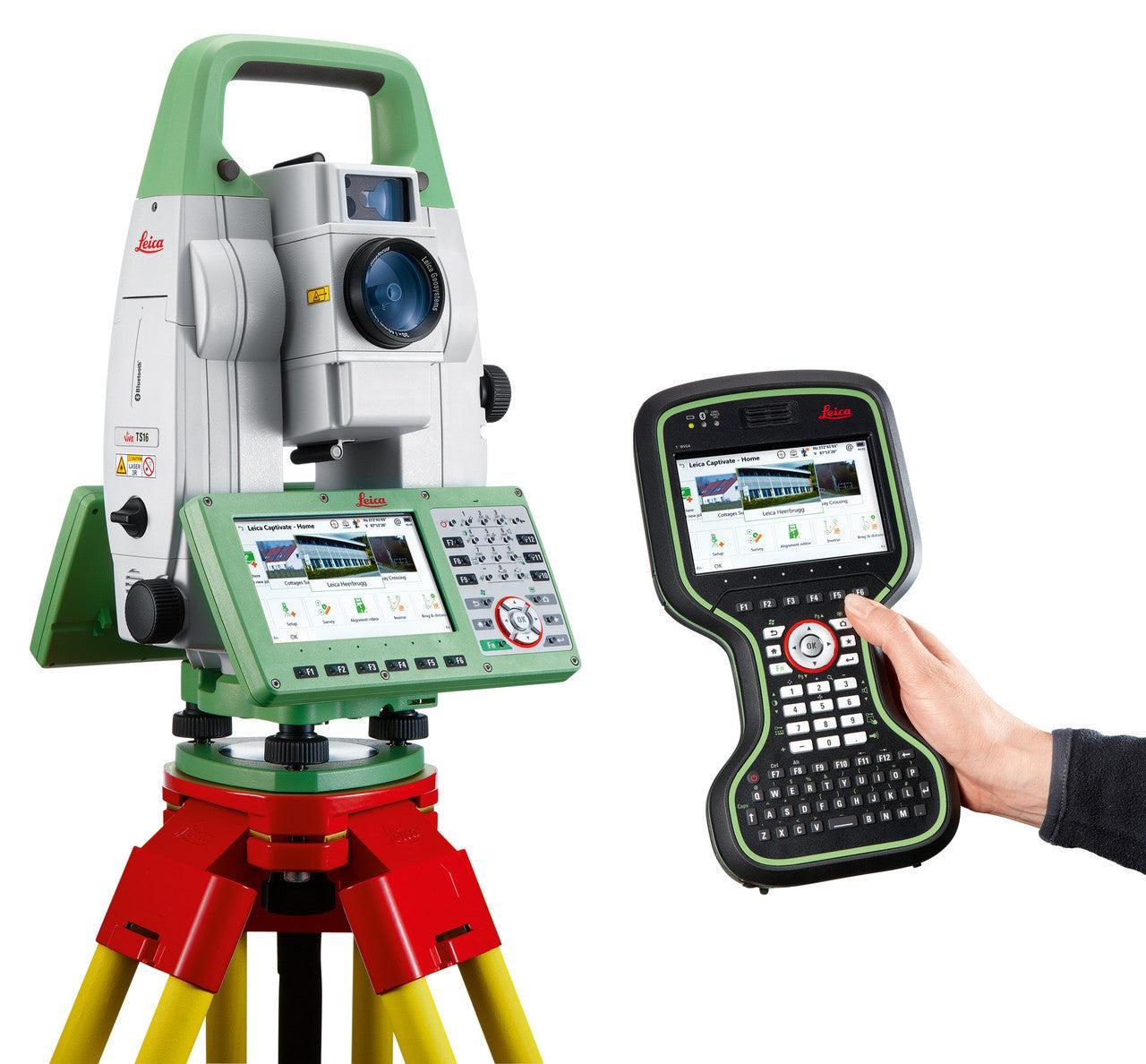


- Best-in-class automated total station for the widest variety of measurement tasks and applications: including one-person or two-person instrument operation for surveying and stakeout.
- Topographic surveying to create digital reality for mapping: control point measurements, adjustments, computations, and data collection with powerful coding and line work routines.
- Highest efficiency and productivity for stakeout and construction
measurements: stakeout design data, as-built checks, BIM and clearance checks. - Site preparation and machine guidance in heavy construction projects: site control, surveying, layout of design data, as-built checks,
machine guidance, and road, rail and tunnel focused workflows. - Quick and reliable monitoring of locations, buildings, and objects in real-time in any environment: perfect for campaign monitoring and scaling up to an automated monitoring solution.
When to use the Leica TS16:
- Best-in-class automated total station for the widest variety of measurement tasks and applications: including one-person or two-person instrument operation for surveying and stakeout.
- Topographic surveying to create digital reality for mapping: control point measurements, adjustments, computations, and data collection with powerful coding and line work routines.
- Highest efficiency and productivity for stakeout and construction measurements: stakeout design data, as-built checks, BIM and clearance checks.
- Site preparation and machine guidance in heavy construction projects: site control, surveying, layout of design data, as-built checks, machine guidance, and road, rail and tunnel-focused workflows.
- Quick and reliable monitoring of locations, buildings, and objects in real-time in any environment: perfect for campaign monitoring and scaling up to an automated monitoring solution.
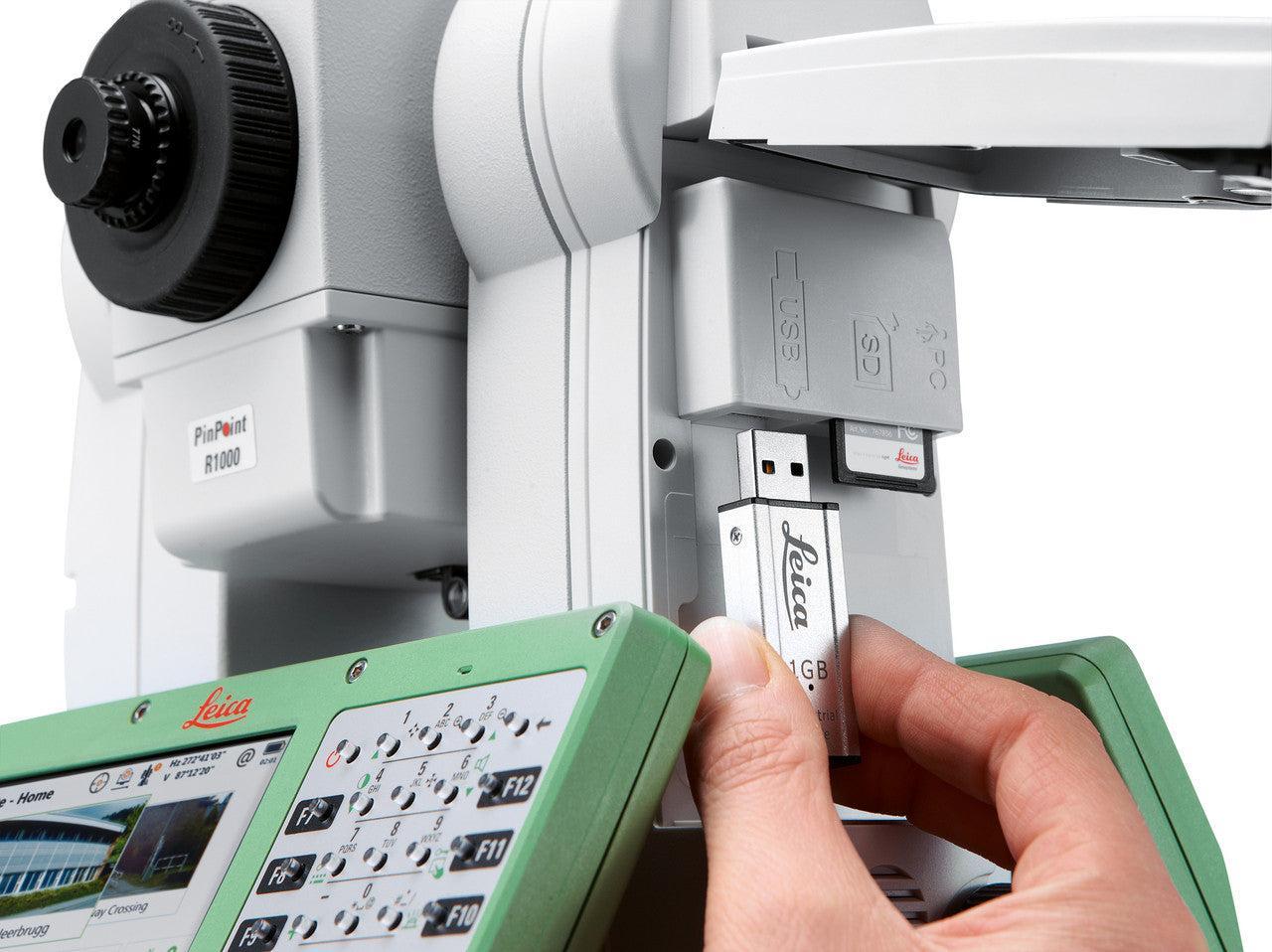
AutoHeight is a feature of the TS16 that helps you get your instrument height with a simple press of a button. This way you can reduce human error, forget about using a tape and always trust the instrument height you measured. Focus on your work and be done with the setup of your total station in the blink of an eye.
In order to always know where your instruments are in the field, you might consider adding LOC8. It not only doubles up as an excellent tracking and fleet management tool; it is also an excellent theft deterrence solution. LOC8 gives you the ability to remotely lock and unlock total stations with just a click of a button through your app or web account.
Leica TS16 comes optionally with DynamicLock – you can move and focus on your work and safety without having to stand and wait for the instrument to lock onto the target:
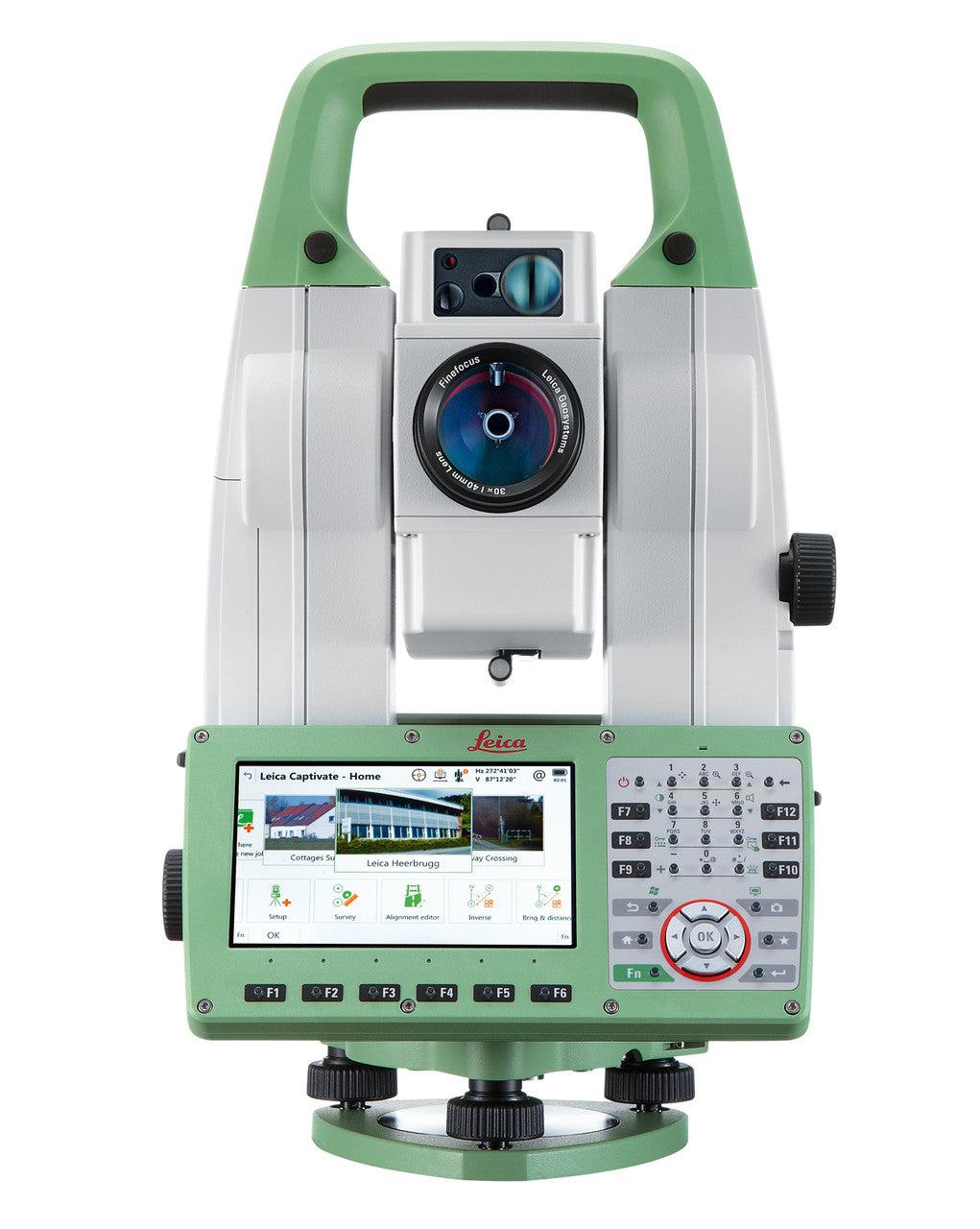
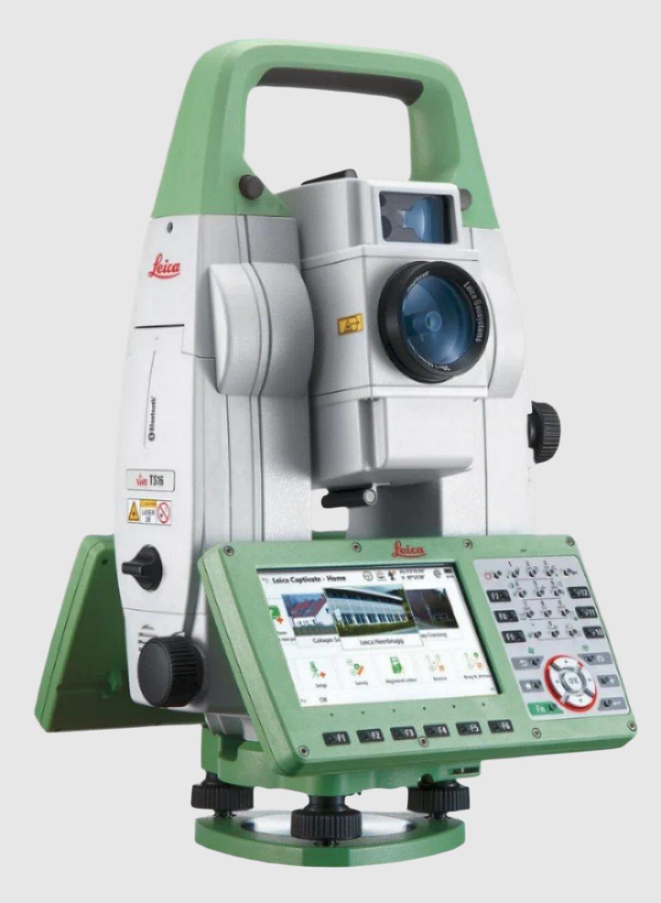
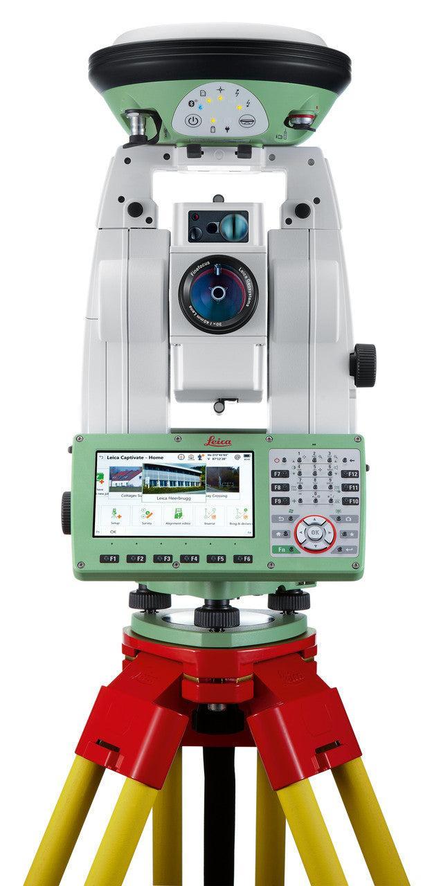
Leica Viva TS16 Self-Learning Robotic Total Station
This item qualifies for free shipping within the continental U.S.

PROVEN
DYNAMIC
SECURE
CONNECTED
R1000: 0.9 m to >1,000 m
Single (prism fast): 2 mm + 1.5 ppm / typically 1.5 s11
Single (any surface): 2 mm + 2 ppm / typically 2 s7
Field of View: 19.4°
Frame Rate: Up to 20 fps
360° prism: 1,000 m / 1,000 m
Darkness: 65 mm @ 300 m
Range: 0.7 m to 2.7 m
Dust & Water: IP55 / 95%, non-condensing
1. Standard deviation ISO 17123-3
2. Overcast, no haze, visibility about 40 km, no heat shimmer
3. 0.9 m to 2,000 m for 360° prisms (GRZ4, GRZ122)
4. Object in shade, sky overcast, Kodak Gray Card (90% reflective)
5. Standard deviation ISO 17123-4
6. Distance > 500 m: Accuracy 4 mm + 2 ppm, Measurement time typ. 6 s
7. Up to 50 m; max. measurement time 15 s for full range
8. Typical laser beam diameter on white, smooth surfaces with intensity 100%
9. TS16G R30: 0.9 m to 30 m
10. Angle accuracies 1“ to 3“, PinPoint R30 & R1000 variants available
11. Initial measurement time typically 2 s