
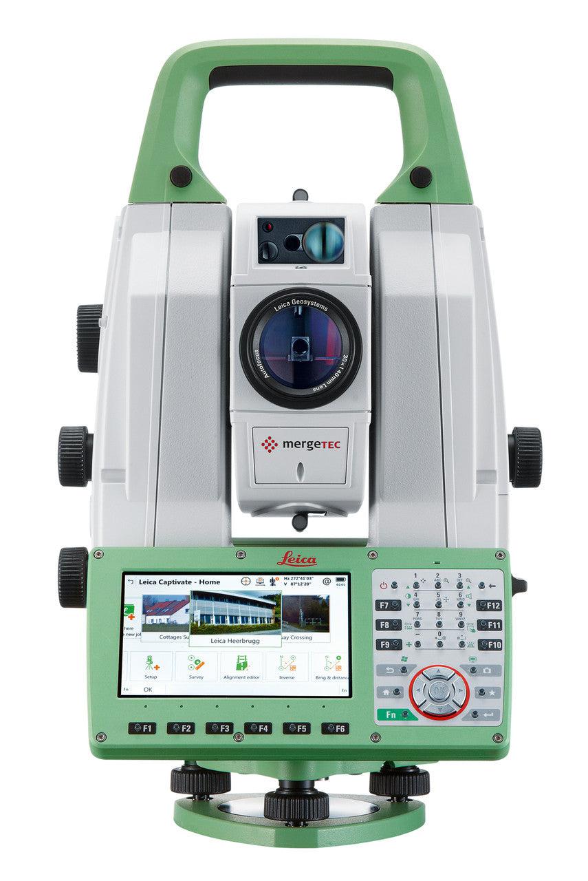


The Leica Nova MS60, the world’s first self-learning MultiStation, enables you to perform all surveying tasks with one instrument. The MS60 is a scanning total station that empowers complete data collection of individual points and large areas by leveraging sensor fusion and automation. Seamlessly integrated into Leica field and office surveying software, you can quickly complete your work on-site and offer a range of high-value deliverables.
The new version of Leica Nova MS60, the world’s first MultiStation, enables you to perform all surveying tasks with one instrument. It brings sensor fusion to the next level by combining:
-
Highest-end total station capabilities
-
3D laser scanning, enabling you to scan up to 30’000 points per second
-
GNSS connectivity
-
Digital imaging
The MS60 comes with Leica Captivate, an onboard software with easy-to-use apps that cover all your surveying tasks. To make your work even more productive, you can benefit from the MS60’s Dynamic Lock feature as well as the newly added, revolutionary setup assistant feature, Autoheight Feature - which helps you setup even faster and more accurately with the simple press of a button.
When to use the Leica Nova MS60:
- Surfaces and volumes in construction and mining: spoil heaps and stock piles, DTM creation and checking surfaces, material thickness, blast faces and ground levels
- Analysis of complex structures and objects within plant, marine and utility projects: dimensional control, as-built and record keeping
- Measuring buildings and structures: bridge condition/clearance analysis, BIM and as-built
- Façade, elevations and heritage work: creation of traditional façade deliverables, 3D models and photographic documentation
- Traditional topographic surveys for surveying and mapping: creation of traditional deliverables like 2D maps or 3D models
- Monitoring measurement and analysis of ground and structures: real-time or periodic measurement of bridges, dams, buildings and earth, ice and snow
Leica Nova MS60 1" R2000 Reflectorless MultiStation
This item qualifies for free shipping within the continental U.S.


Highest-end total station

3D laser scanning

GNSS connectivity

Digital imaging

Dot size: 8 mm × 20 mm @ 50 m
8 kHz mode: 150 m / 1.5 mm @ 50 m
1 kHz mode: 300 m / 1.0 mm @ 50 m
1 Hz mode: 1,000 m / 0.6 mm @ 50 m
Band scan: 400 gon × 50 gon
12.5 mm @ 50 m (45 min)
FOV: 19.4° / 1.5°
1. Standard deviation ISO 17123-3
2. Overcast, no haze, visibility about 40 km, no heat shimmer
3. 1.5 m to 3,000 m for 360° prisms (GRZ4, GRZ122)
4. Object in shade, sky overcast, Kodak Gray Card (90% reflective)
5. Standard deviation ISO 17123-4
6. Distance > 500 m: Accuracy 4 mm + 2 ppm, Measurement time typically 4 s
7. Object in shade, sky overcast, uninterrupted visibility, static target object, Kodak Gray Card (90% reflective)