


The Leica RTC series combines industry leading 3D laser scanning performance with connected software intelligence to help teams capture faster, collaborate instantly, and deliver with confidence. From surveying and construction to public safety, industrial facilities, and infrastructure, the RTC series transforms isolated scanning workflows into one continuous reality capture ecosystem.
Leica RTC300

Agile reality capture for evolving projects.
Leica RTC500

High-performance scanning with operational flexibility.
Leica RTC700

Maximum range and accuracy for the most demanding work.
In The Box
- RTC300 Laser Scanner
- GVP780 Transport Container for RTC
- GEB461 Lithium-Ion Battery
- GKL341 Charger Prof 5000
- RTC Rain Cover
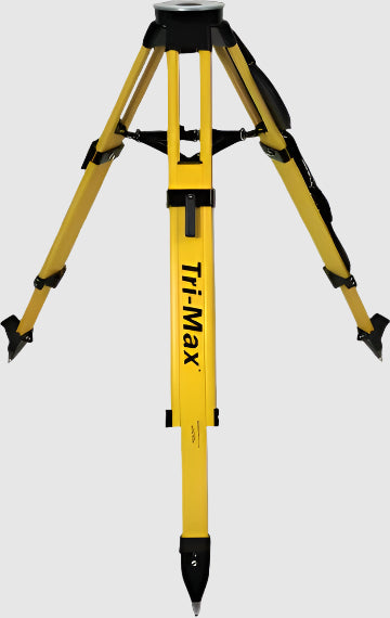
- GST80 Carbon Tripod
- GVP736 Backpack for RTC
- 2 Year Factory Warranty


Leica RTC Series Laser Scanners
This item qualifies for free shipping within the continental U.S.


Welcome to a new dimension in reality capture. One trusted design. Three levels of performance.
Built on Leica Geosystems’ mastery of 3D laser scanning, the new RTC laser scanners bring together superior scanning performance, software, and cloud collaboration into a real-time workflow architecture, creating a new way of working. Capture high-density 3D data with confidence, share progress as it happens, and keep field, cloud and office users aligned in one continuous workflow.

Leica RTC300

Leica RTC500

Leica RTC700
What makes the new RTC Series different?
Higher performance scanning
Field-to-office collaboration
Faster data visualization
Built for the way you already work
Built for specialized reality capture workflows.
Leica RTC supports professionals across industries where accurate, connected 3D data helps teams make better decisions faster.

Surveying

Building construction

Plant and industrial

Public safety and forensics

0.4 mm @ 50 m
3.8 mm @ 50 m
Accuracy: 3" (upright/inverted, ±10° inclination).
Accuracy: 1' (other inclinations).
Runtime: up to 4 hours.
Weight: 340 g (0.7 lbs) each.
IP55 inverted with protection cover (±15° inclination)
RTC500: 130 m
RTC700: 270 m
RTC500: Up to 2,000,000 pts/sec
RTC700: Up to 2,000,000 pts/sec
RTC500: 3, 6, 12, 25 mm @ 10 m
RTC700: 1.6, 3, 6, 12, 25 mm @ 10 m
RTC500: ✔
RTC700: Up to 0.8 mm @ 10 m
RTC500: ~1 min 40 sec
RTC700: ~1 min 40 sec
* Accuracy specifications based on 89% albedo.
* Range noise values based on single-shot measurements.
* All specifications subject to change without notice.
* Scanner laser classification: Class 1 according to IEC 60825-1.