


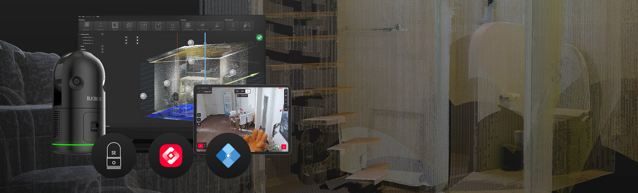
Harness the power of three robust Leica Geosystems tools bundled into one streamlined solution that facilitates the creation of 3D and 2D models with ease. This package delivers all the necessary components to begin scanning and modelling right out of the box, making integrating 3D data capture into your workflow more accessible than ever.
Bring the precision of laser scanning to your next construction, design, building, or architecture project without added complexity. Optimized for small to mid-sized projects, the BLK360 SE Essentials equips professionals, firms, and studios with a straightforward, feature-rich reality capture workflow, enhancing project planning and delivery with the power of 3D data.
Get to Know Your Reality Capture Essentials
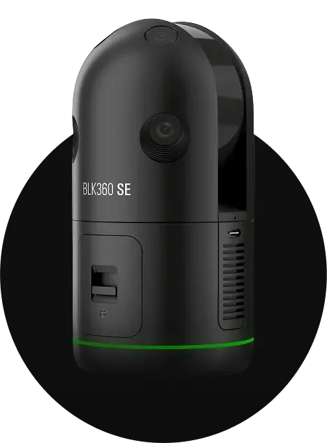
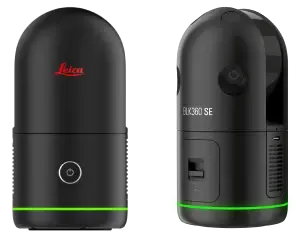
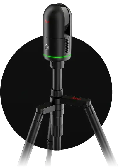
The Leica BLK360 SE is a lightweight, compact imaging laser scanner that efficiently captures point cloud data and spherical imagery of any environment. This edition of the BLK360 maintains the signature one-button operation, user-friendly functionality, software integration and support that Leica Geosystems is known for, engineered for newer users of reality capture tools.
Key Features
- Full dome scan with rich HDR imagery in less than a minute
- 45m range with 4mm accuracy at 10m
- Three scan resolutions capture data in 28, 53, or 170 seconds with detailed point clouds.
- Small and light, measuring 155x80mm and weighing just 850g with batteries
Essential App -- Leica Cyclone FIELD 360
The Cyclone FIELD 360 (BLK Edition) app complements the scanner with an intuitive interface, enhancing fieldwork by integrating field and office workflows. Available for iOS and Android, users can pair it with the BLK360 SE for remote control, scanner setup, and pre-registration of scans in the field for quicker final registration in PinPoint to create an efficient and streamlined workflow. The app also enables real-time previews, on-site feedback, and quality assurance.
Essential Software - Leica PinPoint
Essential Software – PinPoint software further simplifies point cloud processing with an intuitive interface and efficient 3D modelling workflows. Seamlessly compatible with leading 2D and 3D CAD and BIM applications, it allows for easy integration of scan data. Its powerful tools enable users to create surfaces, insert architectural elements, and generate floor plans with measurement reports effortlessly.

Harness the power of three robust Leica Geosystems tools bundled into one streamlined solution that facilitates the creation of 3D and 2D models with ease. This package delivers all the necessary components to begin scanning and modelling right out of the box, making integrating 3D data capture into your workflow more accessible than ever.
Bring the precision of laser scanning to your next construction, design, building, or architecture project without added complexity. Optimized for small to mid-sized projects, the BLK360 SE Essentials equips professionals, firms, and studios with a straightforward, feature-rich reality capture workflow, enhancing project planning and delivery with the power of 3D data.
Get to Know Your Reality Capture Essentials
The Leica BLK360 SE is a lightweight, compact imaging laser scanner that efficiently captures point cloud data and spherical imagery of any environment. This edition of the BLK360 maintains the signature one-button operation, user-friendly functionality, software integration and support that Leica Geosystems is known for, engineered for newer users of reality capture tools.
Key Features
- Full dome scan with rich HDR imagery in less than a minute
- 45m range with 4mm accuracy at 10m
- Three scan resolutions capture data in 28, 53, or 170 seconds with detailed point clouds.
- Small and light, measuring 155x80mm and weighing just 850g with batteries
Essential App -- Leica Cyclone FIELD 360
The Cyclone FIELD 360 (BLK Edition) app complements the scanner with an intuitive interface, enhancing fieldwork by integrating field and office workflows. Available for iOS and Android, users can pair it with the BLK360 SE for remote control, scanner setup, and pre-registration of scans in the field for quicker final registration in PinPoint to create an efficient and streamlined workflow. The app also enables real-time previews, on-site feedback, and quality assurance.
Essential Software - Leica PinPoint
Essential Software – PinPoint software further simplifies point cloud processing with an intuitive interface and efficient 3D modelling workflows. Seamlessly compatible with leading 2D and 3D CAD and BIM applications, it allows for easy integration of scan data. Its powerful tools enable users to create surfaces, insert architectural elements, and generate floor plans with measurement reports effortlessly.
SKU:
Leica BLK360 SE ESSENTIALS
This item qualifies for free shipping within the continental U.S.
Diameter: 80 mm