
Leica Zeno FLX100 Plus
    Leica Zeno FLX100 Plus
    Leica Zeno FLX100 Plus
    Leica Zeno FLX100 Plus
    Leica Zeno FLX100 Plus
    Leica Zeno FLX100 Plus
    Leica Zeno FLX100 Plus
    Leica Zeno FLX100 Plus
Leica Zeno FLX100 Plus
    Leica Zeno FLX100 Plus
    Leica Zeno FLX100 Plus
    Leica Zeno FLX100 Plus
    Leica Zeno FLX100 Plus
    Leica Zeno FLX100 Plus
    Leica Zeno FLX100 Plus
    Leica Zeno FLX100 Plus
Leica Zeno FLX100 Plus
Details

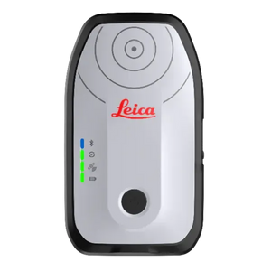
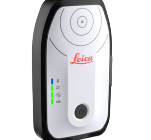
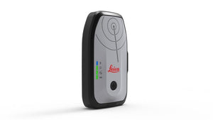
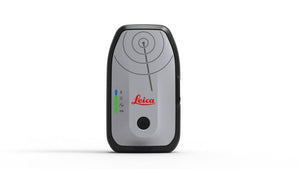
Capture high-accuracy GNSS data—your way—with the Leica Zeno FLX100 Smart Antenna. Designed for mobile GIS, utility mapping, and field data collection, the FLX100 offers sub-meter to centimeter-level accuracy in a compact, lightweight form.

Whether you're using your own smartphone or tablet, or pairing it with a survey pole and RTK network like HxGN SmartNet, the FLX100 adapts to your workflow.


Key Features:

  • Universal Compatibility: Pair with Android or iOS devices using a universal handheld tray

  • High-Precision RTK Support: Mount on a survey pole and connect to HxGN SmartNet for centimeter accuracy

  • Flexible Software Options:

    • Use Leica Zeno Mobile for an end-to-end professional data collection experience

    • Or integrate high-accuracy GNSS with third-party apps using Leica Zeno Connect

  • Simple & Scalable: Ideal for GIS professionals, utilities, environmental surveys, asset management, and more

  • Lightweight & Portable: Easy to carry in the field, with fast setup and intuitive operation


Whether you’re collecting points for mapping, asset inventory, or infrastructure inspections, the Leica FLX100 delivers reliable GNSS performance—anytime, anywhere.


Leica Geosystems Leica Geosystems

SKU:LE-958981

Leica Zeno FLX100 Plus

Regular price
$6,350.00
Sale price
$6,350.00
Regular price
Shipping calculated at checkout.
Model:
Download Product Spec Sheet
Free Shipping Available

Free Shipping on Levels, Lasers, Locators, Total Stations and Digital Theodolites

Want more Information?

Not sure if this fits your setup? Ask us before you buy.

Request More Info
flx100_adapt

Adapt to your needs

The Leica Zeno FLX100 plus smart antenna is an accurate, compact and flexible solution for everyone, allowing you the freedom to work how you want. Choose the setup that best suits your workflow, whether it’s mounted on a survey pole for high-accuracy or used with the Universal Handheld Tray. The FLX100 plus can be paired with your smartphone or tablet running iOS, Android or Windows, giving you the flexibility to work your way.
tiltcompensation

Tilt your way

The Leica Zeno FLX100 plus smart antenna includes tilt compensation technology, enabling you to tilt the antenna in any direction and still measure accurate points. Effortlessly measure points on the move, reach previously inaccessible points, and stake out locations faster and more efficiently than ever before.
icon_proven icon_secure

Your reliable companion

Built to withstand the harshest worksites, the FLX100 plus is designed for durability and reliability straight out of the box. Its rugged construction ensures it can handle the toughest conditions with ease, making it a trusted companion for demanding tasks. Additionally, Leica Geosystems offers comprehensive maintenance, service, and professional support, ensuring your device remains operational and performing at its best, no matter the challenges you face.
GNSS TECHNOLOGY
Horizontal Real-Time Accuracy
RTK (Multi-frequency): 2 cm + 1 ppm*
SBAS (L1 only): <0.9 m*
Navigated: 1.2 m*
Vertical Real-Time Accuracy
RTK (Multi-frequency): 3 cm + 1 ppm*
Real-Time Tilt-Compensated Accuracy
Unlimited tilt. Additional Hz uncertainty < 1.8 cm down to 30° tilt
Post-Processing Static Accuracy
Horizontal: 2 cm + 1 ppm*
Vertical: 3 cm + 1 ppm*
Satellite Signal Tracking
GPS (L1 C/A, L2C)
Glonass (L1OF, L2OF)
BeiDou (B1I, B2I)
Galileo (E1B/C, E5b)
QZSS (L1C/A, L2C)
SBAS: WAAS, EGNOS, MSAS, GAGAN (L1 C/A)
Number of Channels
184 channels
Update Rate
Up to 10 Hz (0.10 sec)
Supported Operating Systems
Android, iOS, Windows
Real-Time Protocols
RTCM 3.0, 3.1, 3.2, 3.3, RTCM MSM
Output Protocols
NMEA via Zeno Connect
GNSS Initialization
Cold Start: 24 sec
Reacquisition: 2 sec
USER INTERFACE & COMMUNICATION
User Interface
On/Off key with status indicator (LED) – satellite, corrections, Bluetooth®, battery
Communication Port
Bluetooth® 5.0
POWER MANAGEMENT
Battery
Internal (3.8 V / 6120 mAh)
Charging Time
4 hours to full charge
Power
DC 5V / 2A
Operating Time
>20 hours
PHYSICAL SPECIFICATIONS
Weight & Dimensions
319 g, 139 mm x 80.6 mm x 31 mm
Water, Sand, Dust Protection
IP67
Operating / Storage Temperature
Operating: –40 to +65 °C
Storage: –40 to +80 °C
Humidity
Rarely and slightly condensing. ISO 9022-12-04 (+65 °C, 92 %, 62 h)
Drop
1.2 m
Vibration
Withstands strong vibration (ISO 9022-36-05, 10–55 Hz / ±0.15 mm / 5 cycles)

Check Out These Related Products