


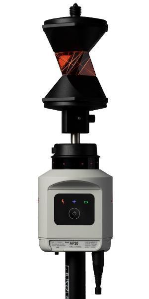


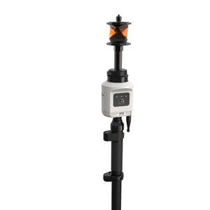

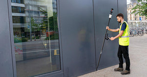
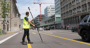
The Leica AP20 AutoPole is a cutting-edge smart system designed for Leica robotic total stations. It seamlessly integrates with Leica field software to enhance digital Survey and Construction workflows. This innovative tool boosts precision and productivity across various phases with features like unique target search and identification, automatic pole height readings, real-time updates in the field software, and pole tilt compensation. The AP20 AutoPole ensures faster, more reliable layouts, as-builts, and other measurement tasks, reducing errors and minimizing rework and delays.
The Leica AP20 AutoPole is a revolutionary smart system for Leica robotic total stations that is easy to use and enhances the digital construction workflows of Leica iCON field software with a seamless integration. Whether in building or heavy construction, it resolves critical challenges construction professionals experience daily with the total station operation and deliverers a true digital construction workflow by removing the last analogue step in the process, the pole. The AP20 AutoPole brings precision and productivity gains to different construction phases, with unique target search and identification, automatic pole height readings and updates in the field software and pole tilt compensation. The AP20 AutoPole enables faster and more reliable layout, as-builts and other measurement tasks, which are completed with less mistakes, minimizing rework and delays.
Leica AP20 AutoPole is the only smart system on the market that solves three common workflow problems surveying and construction professionals face daily:
- Entering the pole height manually into the field software
- Having to level the pole
- Accidentally locking to a foreign target at a busy site
The AP20 helps users work more efficiently, trust the data they gather and increase productivity overall. The result is faster completion of projects while maintaining high quality standards.
SKU:LE-922841
AP20
Free Shipping on Levels, Lasers, Locators, Total Stations and Digital Theodolites


Pole Height

Tilt Compensdation

Target ID
Specifications
POLEHEIGHT
TILT COMPENSATION
TARGETID
GENERAL
1. Measurement precision, accuracy, reliability and time for initialisation are dependent upon various factors including angular and distance accuracy of the total station, target type, atmospheric conditions, target height and level of pole tilt.
2. Free line of sight to target required
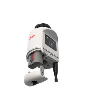
3. Using radio handle RH18 or CCD18 connected to AutoPole
4. Requires total station with target lock functionality and radio handle RH18 or CCD18
5. Requires total station with prism fast search functionality
6. Metric scale
7. Feet scale